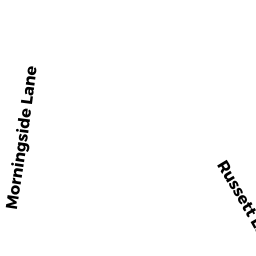
46 RUSSETT LANE
Owner Information
HOLLAND, C. TRAVIS
46 RUSSETT LANE
NORTH ANDOVER, MA 01845


Property Details
46 RUSSETT LANE is classified as a Single Family Residential (Colonial).
The primary structure on this property was built in 1974. There are 2,977ft2 of built area within this property. There is 2,977ft2 of residential/living space within this property. This property is listed as having 9 rooms.
46 RUSSETT LANE is valued at $524,800. The land is valued at $258,200 and the structures are valued at $265,600. There is an additional valuation of $1,000 on this property.
This property is in Zone R1. Confirm with local Zoning Board authorities to ensure there are no overlays or other easements on this property.
The most recent deed for 46 RUSSETT LANE is recorded at the local registrar in Book 16711, Page 69. 46 RUSSETT LANE was last sold on Wednesday, January 13, 2021 for $10.
Assessment data from fiscal year 2022.
Flood Data
According to the FEMA National Flood Hazard Layer, this property does not appear to be in a flood zone. It may also be in an area not yet reviewed. Nonetheless, confirm this information prior to taking any action.
To view the flood hazards around this property, create a FEMA "Firmette" Map of the area around 46 RUSSETT LANE.
Broadband Internet Providers
| Provider | Type | Bandwidth (mbps) | |
|---|---|---|---|
| Comcast | Cable | 1000 | 35 |
| VSAT Systems, LLC. | Satellite | 2 | 1 |
| HughesNet | Satellite | 25 | 3 |
| GCI Communication Corp. | Satellite | 0 | 0 |
| T-Mobile | Fixed Wireless | 25 | 3 |
| Verizon New England Inc. | Fiber | 940 | 880 |
| Viasat Inc | Satellite | 100 | 3 |
Broadband service provider data from December 2020.
Adjacent Properties
- 36 RUSSETT LANE
Single Family Residential owned by VEASY, THOMAS - 58 RUSSETT LANE
Single Family Residential owned by YOUNG, KEITH, E. - 58 RUSSET LN
Undevelopable Residential Land owned by YOUNG KEITH E - 46 RUSSET LN
Undevelopable Residential Land owned by HOLLAND TRAVIS - 36 RUSSET LN
Undevelopable Residential Land owned by VEASY THOMAS